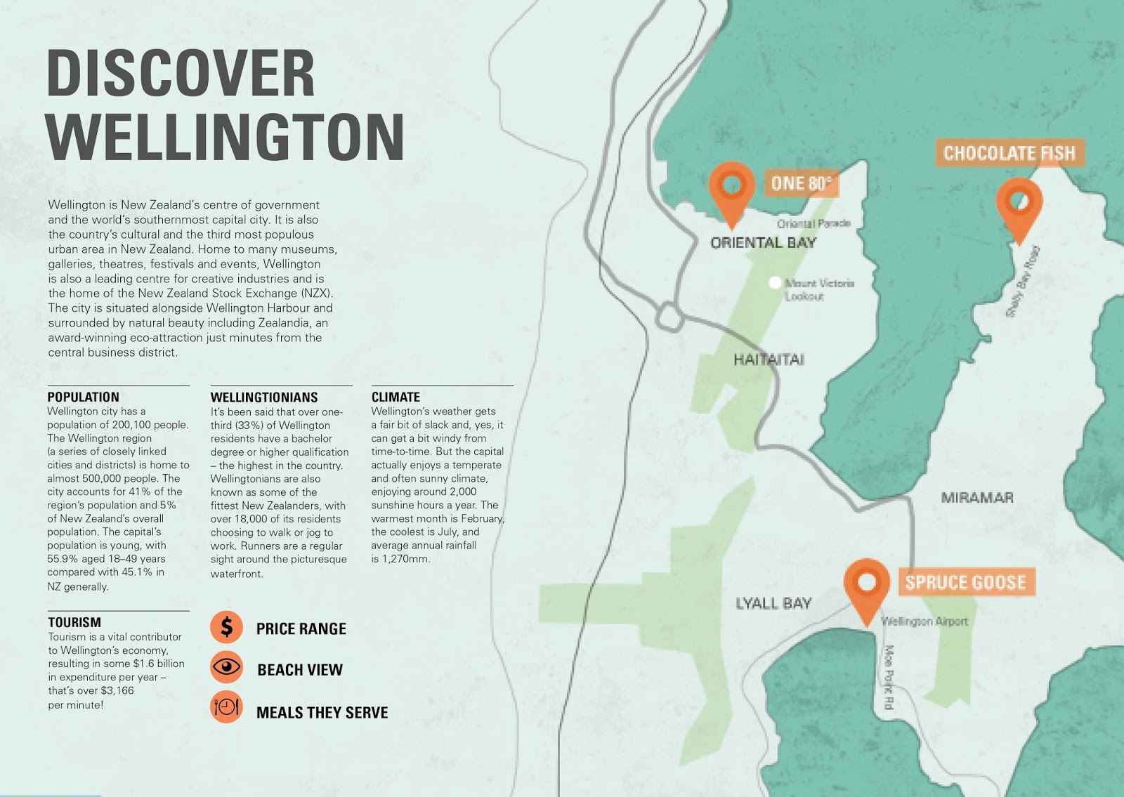
Today we worked on our maps. We quickly sketched up our current map on a piece of napkin to see if others could follow it. Looking at my map I made through photoshop, I think you can clearly identify how far apart my 3 locations are. Since my locations are very far apart, I don't need to include all the street names, only the ones relevant to my location. I don't think it's necessary to having a key to determine where my locations are. I already have a map marker symbol along with the cafe/restaurant name.
To ensure that my map fits the overall style of my brochures, I made the ocean that surrounds the locations blue to match my current color palette. I also wanted my map to flow across the spread. The black lines I've drawn may not be so useful in terms of navigation so i'll have to redo the lines so that it makes somewhat more sense to the reader.
No comments:
Post a Comment